WEST MICHIGAN LAKESHORE616.935.2121
WEMAD — West Michigan Aerial Documentation LLC. A Higher Perspective.

WEST MICHIGAN AERIAL PHOTOGRAPHY & DOCUMENTATION

Your property.
Your progress.
A higher perspective.

Get a clear look at your roof, follow a new home or addition while you’re away, or show a venue at its best. WEMAD provides aerial photography, progress updates, site mapping, and interior construction records across West Michigan.

Explore a real WEMAD property model in 3D
HOMEOWNERS · BUILDERS & REMODELERS · VENUES
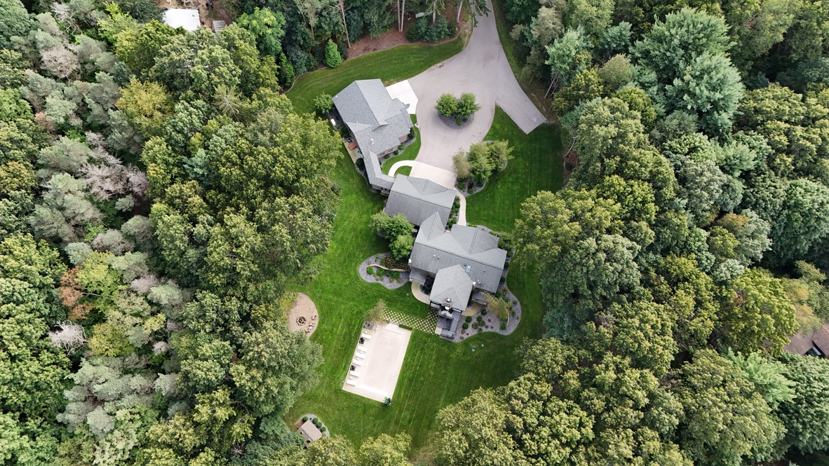
Aerial view of a wooded home property showing the rooflines, lawn, buildings, and driveway
HOMES · ROOFS · PROPERTY

See your place from a new perspective.

One photo visit, a milestone, or a record that grows with your project.
Explore WEMAD’s interactive 3D model of Port 393 in Holland, Michigan
INTERACTIVE 3D · PORT 393Turn it. Zoom in.
Explore the property.
Explore in 3D
FAA Part 107 certified pilots
Insured aerial operations
Local West Michigan service
A HIGHER PERSPECTIVE™
Featured Service · WEMAD Complete Digital Home Record

One home. Every detail.
All in one place.

The builder's ultimate handoff. The homeowner's lifetime reference.

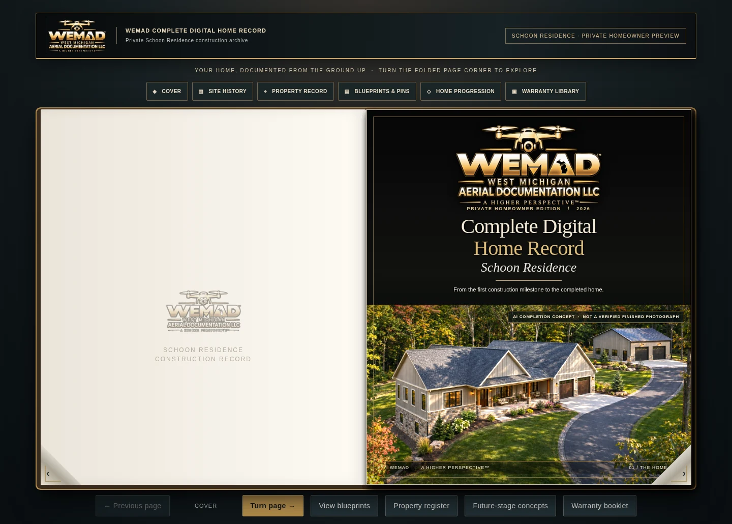
Your home has a story most people never get to keep. WEMAD brings construction milestones, aerial progress photos, original floor plans, pre-drywall photo locations, and product manuals and warranties into one beautiful, page-turning digital record.

Imagine opening a floor-plan pin years from now to review what was photographed behind a wall — before remodeling a kitchen, adding a room or making repairs. At resale, give prospective buyers an organized history of your home's improvements and documentation instead of a box of forgotten paperwork.

BuildersGive buyers a memorable, premium handoff that showcases the entire build.
HomeownersKeep a practical reference for maintenance, repairs and hidden-wall information.
Renovations & ResaleShare documented work, materials and product information when the time comes.

Illustrative Schoon sample: AI-generated exterior completion concepts, proposed system routes and fictional warranty entries are labeled demonstrations, not verified as-builts. Actual captures, measurements, manuals, links and delivery terms are scoped to each project. Documentation does not guarantee a higher sale price.

WEMAD-branded Schoon Residence digital home record: gold logo and illustrative finished house cover

Explore the interactive sample • Turn pages • Open blueprint pins • Browse warranties

GOOGLE CUSTOMER REVIEWS

What Our Customers Say

Hear directly from the people who have trusted WEMAD with their property.

REAL PROPERTY. REAL PERSPECTIVE.

Port 393.
Explore it in 3D.

Turn the site. Move closer. See how it all fits together.

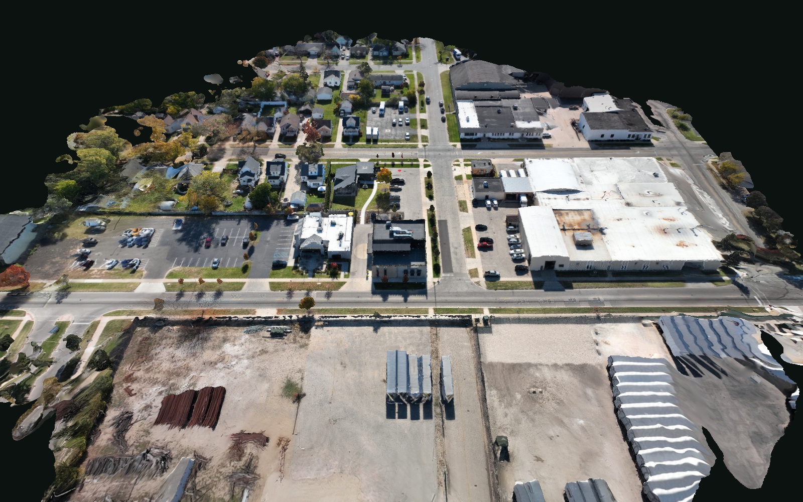
Explore the Holland, Michigan venue and its surroundings through a textured 3D model built from WEMAD’s original aerial photographs.

Angled view of WEMAD’s textured 3D model of Port 393 and the surrounding Holland neighborhood
YOUR MOUSE. A WHOLE NEW VIEW.Drag to rotate · Scroll or pinch to zoom
ORIGINAL WEMAD FIELDWORK

PORT 393 · HOLLAND, MICHIGAN Capture: October 28, 2026 · Photogrammetry of visible surfaces

Open the dedicated 3D view

THE ESTATE. THE GROUNDS. THE PROGRESS.

The Belvedere.
Explore it in 3D.

Turn the property. Follow the setting. See the pavilion site in context.

Explore the Saugatuck, Michigan estate through a textured 3D model built from WEMAD’s original aerial photographs.
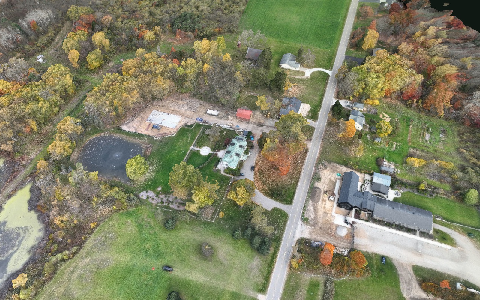
Angled view of WEMAD’s textured 3D model of The Belvedere and the surrounding Saugatuck estate and pavilion site
YOUR MOUSE. A WHOLE NEW VIEW.Drag to rotate · Scroll or pinch to zoom
ORIGINAL WEMAD FIELDWORK

THE BELVEDERE · SAUGATUCK, MICHIGAN Capture: October 31, 2026 · Photogrammetry of visible surfaces

Open the dedicated 3D view
WATCH THE BUILD · 58 SECONDS

Build. Document.
Remember.

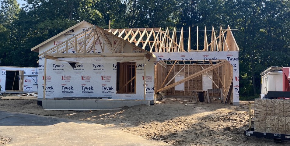
Follow a home from the ground up, then step inside before drywall. See how aerial and interior photographs can preserve the memories—and the visible wiring, plumbing, and HVAC details.

For owners. A property you can explore and share.

For builders & remodelers. A common view for site conversations.

For venues. A new way to show the setting.

What would your property look like from here?

Let’s document your property

FOR YOUR HOME. FOR THE YEARS AHEAD.

Your memories.
Your largest investment.

Your home is more than a construction project. It’s a place you’ve imagined, planned, and invested in.

Whether it’s a new home, a remodel, an addition, or a vacation home, you can follow the progress even when you’re out of town. Agree on the milestones you want to see, receive dated photographs, and keep an interior record before the walls close. We work directly with homeowners and coordinate access with your builder.

Save the memories and visible details of your home, with a photo record you can return to over the years.

Plan my home documentation

2D & 3D MAPPING · AT A GLANCE

See your property.
With more context.

Explore how an overhead map and a 3D model can help you understand a property before, during, and after construction.

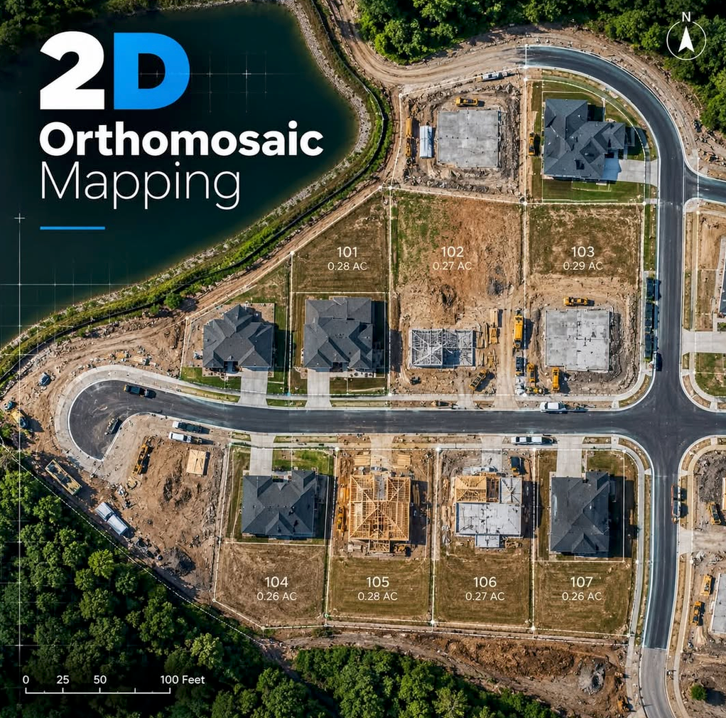
Illustrative 2D orthomosaic map of a residential development with sample lot labels and a scale barView full image
01 / 2D ORTHOMOSAIC

An overhead view of the property.

See lots, access, and visible features together. Sample lot labels show how a map can be organized.

Illustrative example supplied for this site.
3D
Photogrammetry
Modeling
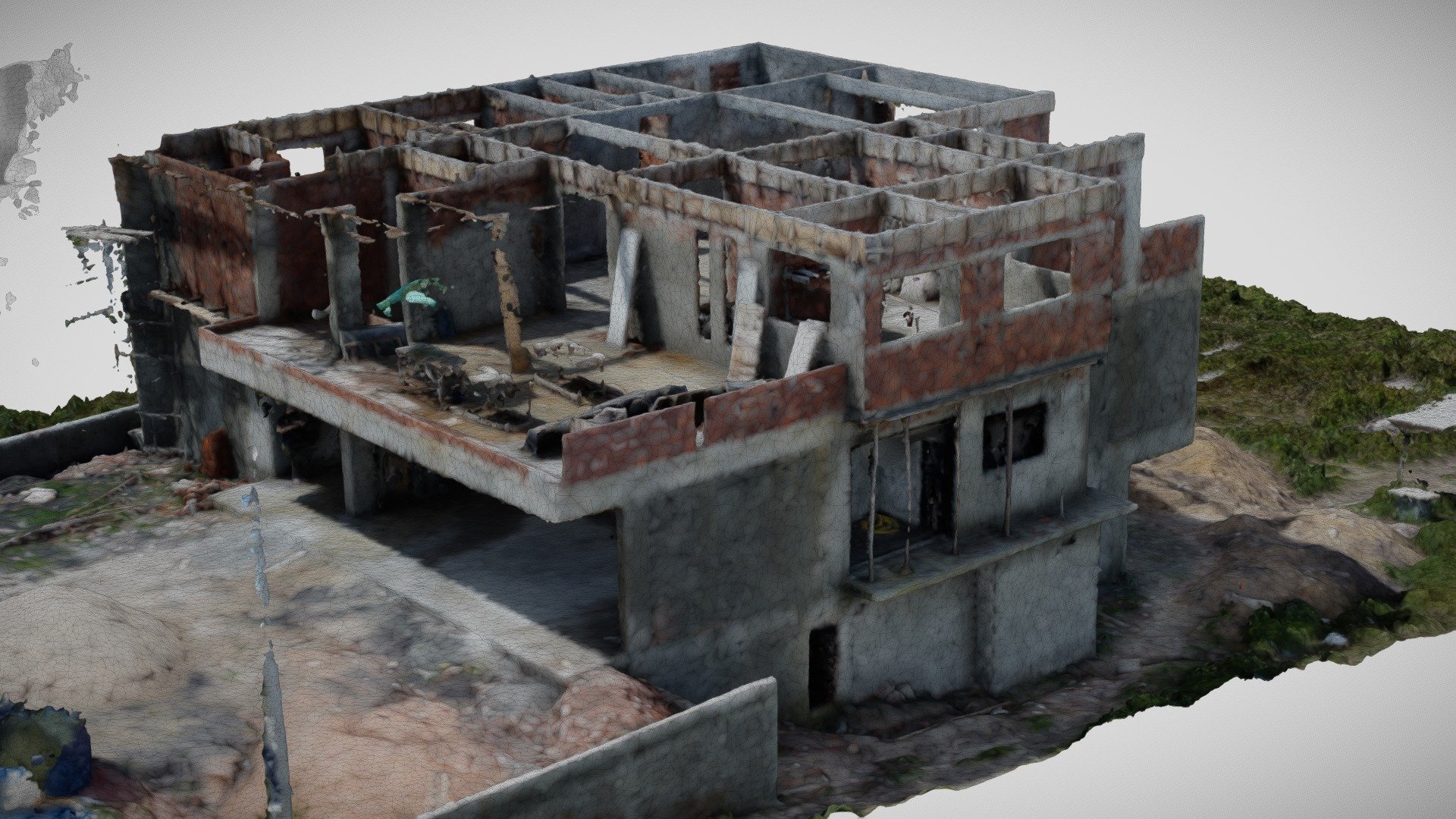
Example photogrammetry model of a two-story house under construction, by vitoremmView full image
02 / 3D PHOTOGRAMMETRY

A model with shape and depth.

See a structure’s visible form and relationships from a different angle.

Example model: Modern_ House_ Construction by vitoremm · CC BY 4.0.
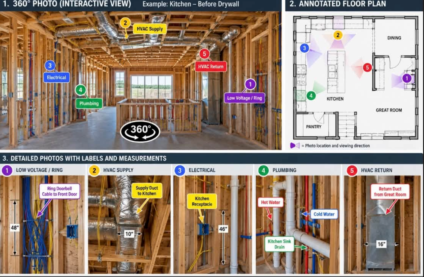
Illustrative kitchen documentation showing labeled systems, a matching floor plan, and sample measurements
Illustrative example · Sample notes and measurements · Click to enlarge

BUILDING, ADDING ON, OR REMODELING?

Your home is more
than the finished walls.

Years from now, you may want to remember the build—or look back at the wiring, plumbing, and HVAC before they were covered. We help you keep both the memories and the practical details, with visits coordinated around your builder’s schedule.

  • Milestone photographs from the air and inside your home
  • Room-by-room photographs and 360° views, as scoped
  • Agreed measurements recorded on site as notes
  • Photo locations linked to your supplied floor plan
  • Organized files for owners and project teams

MORE THAN A FOLDER OF PHOTOS

A record you can
find your way around.

Start with a location on your floor plan. Open the associated photo record. Review notes about the details that matter.

Explore an example room view, linked floor plan, and tagged details. Your record uses your project’s images, plan, and agreed notes.

Discuss your project
WEMADHOME DOCUMENTATION
EXAMPLE RECORD
KitchenMain floor / Before drywall
Illustrative pre-drywall kitchen with tagged electrical, plumbing, low-voltage, and HVAC details
MAIN FLOOR
Illustrative main-floor plan linking the kitchen to five tagged system details
KITCHEN · ROOM VIEW
5 linked details · Click a marker to explore

Illustrative photos, plan, and notes. Field measurements are recorded on site.

PURPOSEFUL EQUIPMENT. PLANNED CAPTURE.

Professional platforms.
Purposeful results.

Two aerial platforms with distinct roles. We match the aircraft, capture plan, and deliverables to your project.

MAPPING & SITE MODELING

DJI Matrice 4E

Construction mapping platform

Our mapping-focused platform for planned, overlapping image capture. Its 4/3-inch 20MP wide camera and mechanical shutter support photogrammetry workflows for 2D orthomosaics and 3D site models.

  • Mechanical shutter on the wide camera
  • Built-in RTK capability
  • Planned mapping and repeat site capture
Discuss your mapping scope
PROGRESS & AERIAL IMAGERY

DJI Mavic 4 Pro

Creator Combo · Aerial imaging platform

Our aerial imaging platform for detailed progress photographs, video, and property context. Its three-camera system includes a 4/3-inch Hasselblad main camera capable of 100MP photographs.

  • 100MP Hasselblad main camera
  • Wide, medium tele, and telephoto views
  • Visual updates for owners and project teams
Plan progress coverage

RTK is an equipment capability, not a blanket accuracy guarantee. Any required corrections, site control, measurement standards, and validation are agreed for the project. Visual mapping does not establish legal property boundaries.

OUR WORK · IVY HOUSE · 2D ORTHOMOSAICS

See the site.
Clarify the work.

Explore 2D & 3D mapping

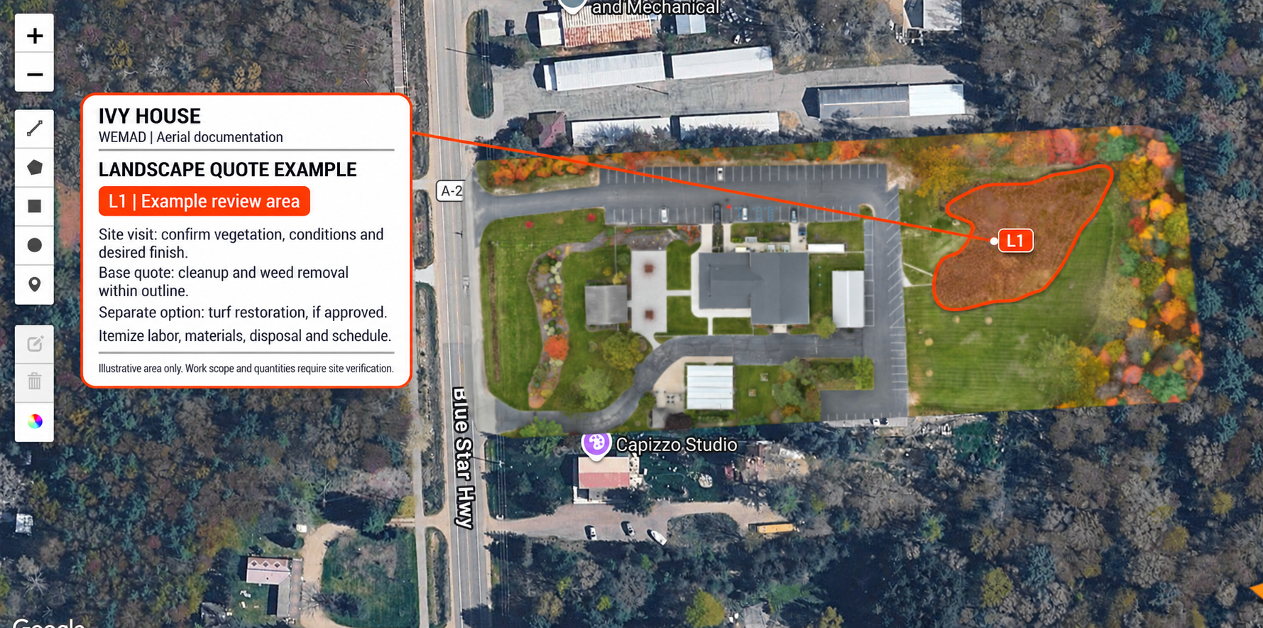
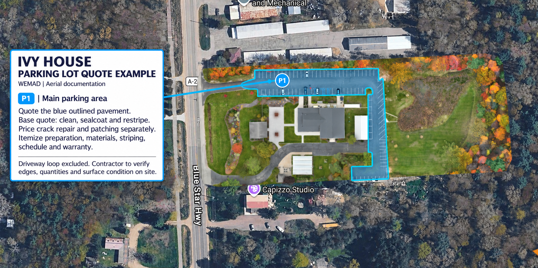
What is a 2D orthomosaic? Overlapping drone photographs are combined and corrected for perspective and scale to create one detailed overhead map of a property.

Owners can plan improvements and keep a dated property record. Builders can coordinate site work and show visible progress. Remodelers can review the existing layout before an addition or exterior renovation.

Marking the same work area for every contractor helps you compare quotes, clarify what is included, and reduce misunderstandings. Repeat visits can document visible changes as work progresses.

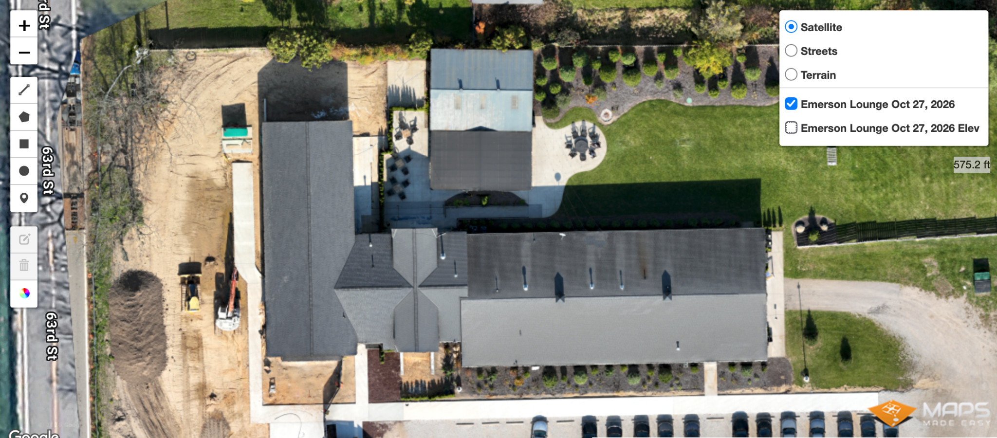
OUR WORK · EMERSON LOUNGE · OCTOBER 27, 2026

One site.
Two ways to understand it.

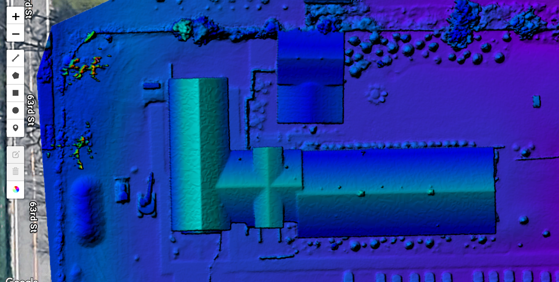
These views come from the same WEMAD mapping capture. The photographic map records visible conditions; the elevation view emphasizes the shape of visible surfaces. Together, they give owners and project teams a clearer starting point for planning and communication.

WEMAD photographic orthomosaic of Emerson Lounge showing the building roofs, courtyard, landscaping, parking, and adjacent site work on October 27, 2026

01 / PHOTOGRAPHIC ORTHOMOSAIC

See what is on the site.

Overlapping drone photographs become one corrected overhead map. Here, the roof layout, courtyard, landscaping, and area of site work can be reviewed together—a dated reference for scope discussions and future comparisons.

Open the full photo map
Colorized photogrammetric surface elevation view of Emerson Lounge, showing the modeled form of roofs, open areas, and vegetation from the same mapping capture

02 / SURFACE ELEVATION MODEL

Understand the elevation context.

The colored view displays modeled surface elevation. Colors and relief shading make differences in height easier to see across the roofs, open areas, and planting. It adds context for planning discussions and closer site investigation.

Open the full elevation view

WHY THEY LOOK DIFFERENT

The same photos can tell two stories.

Photogrammetry compares matching details in overlapping photographs to estimate the shape of visible surfaces. The orthomosaic keeps the photographic colors and detail. The elevation display uses assigned colors and shading to emphasize modeled height. Its colors represent elevation, not temperature or moisture.

Roofs and vegetation are part of this surface model; ground hidden beneath them may not be visible. Use the selected elevation scale and verified data for numerical interpretation. Drainage or grading decisions depend on verified ground elevations.

FOR OWNERS

Plan with a shared reference.

Keep a dated record, explain improvement areas to contractors, and compare visible conditions before and after work.

FOR BUILDERS

Keep the team oriented.

Discuss access, work areas, and existing structures with owners and trades. Repeat capture can help communicate visible progress.

FOR REMODELERS

Understand the existing setting.

Review how the building, courtyard, and landscape fit together before planning an addition or exterior renovation.

OUR WORK · THE BELVEDERE & NEW PAVILION

The Belvedere.
Progress from above.

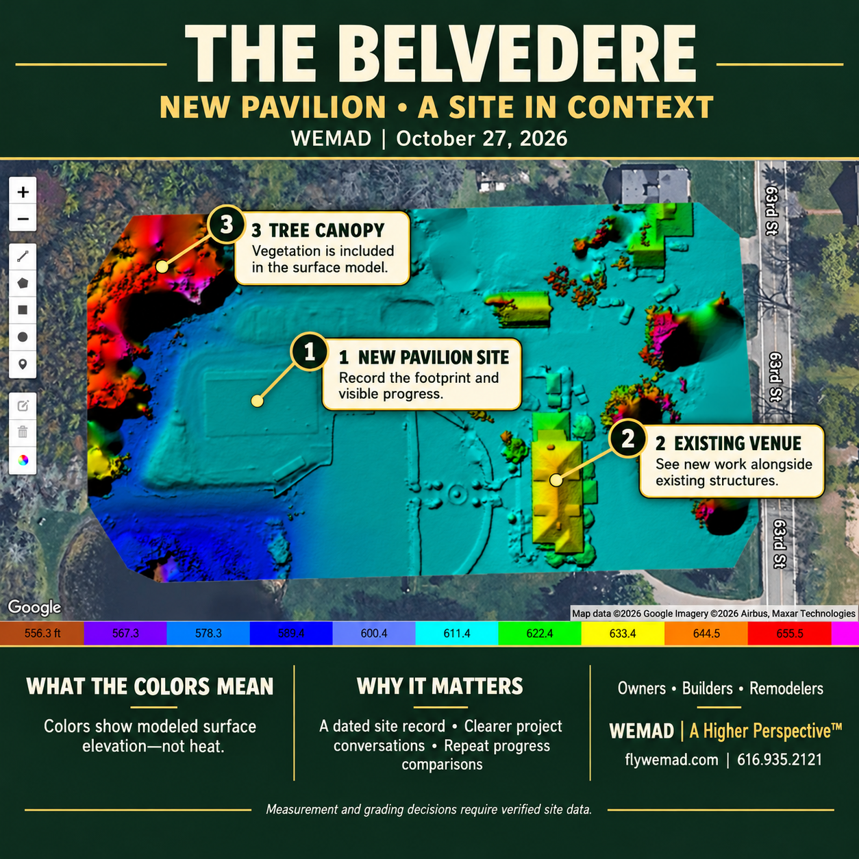
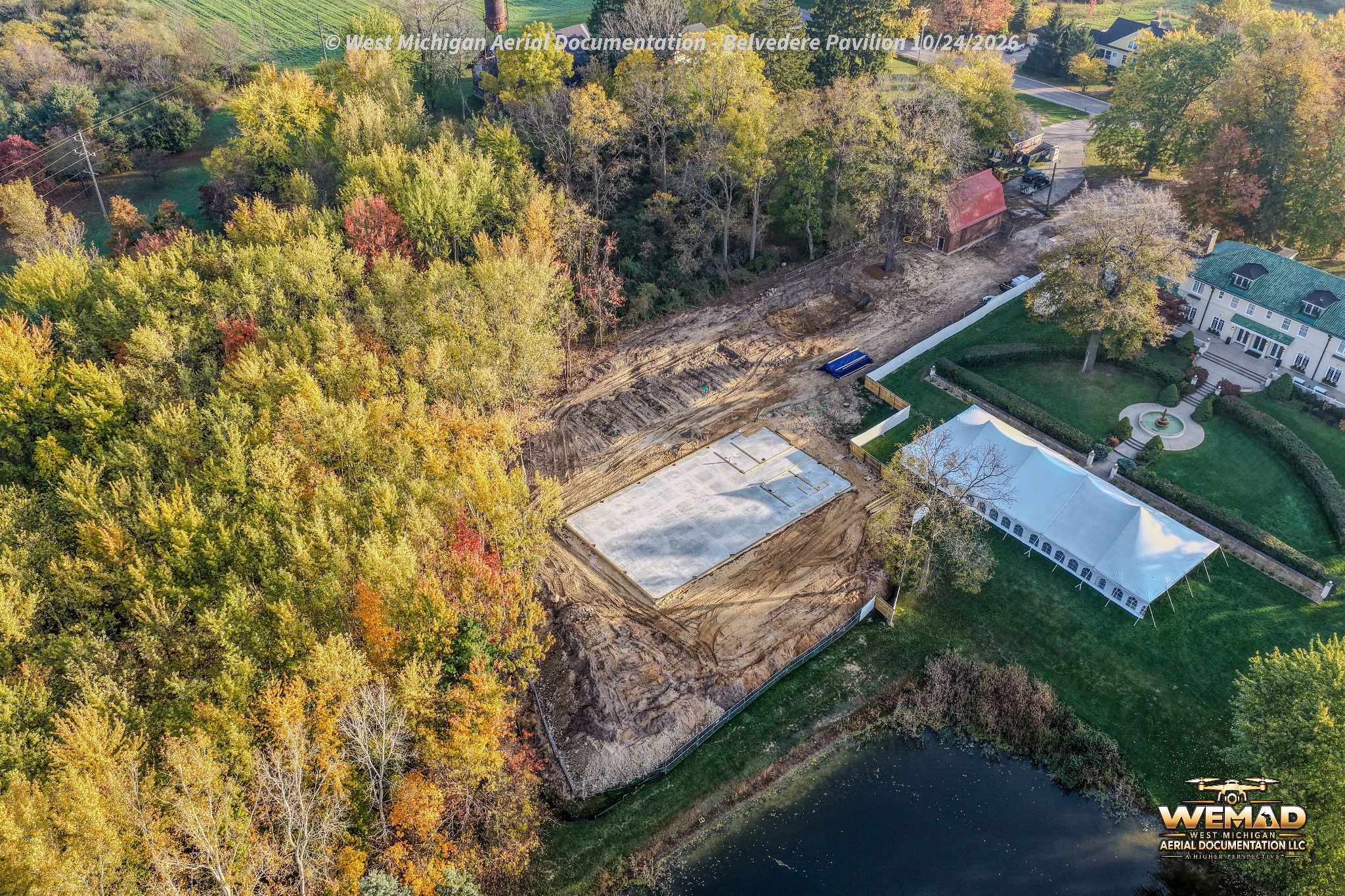
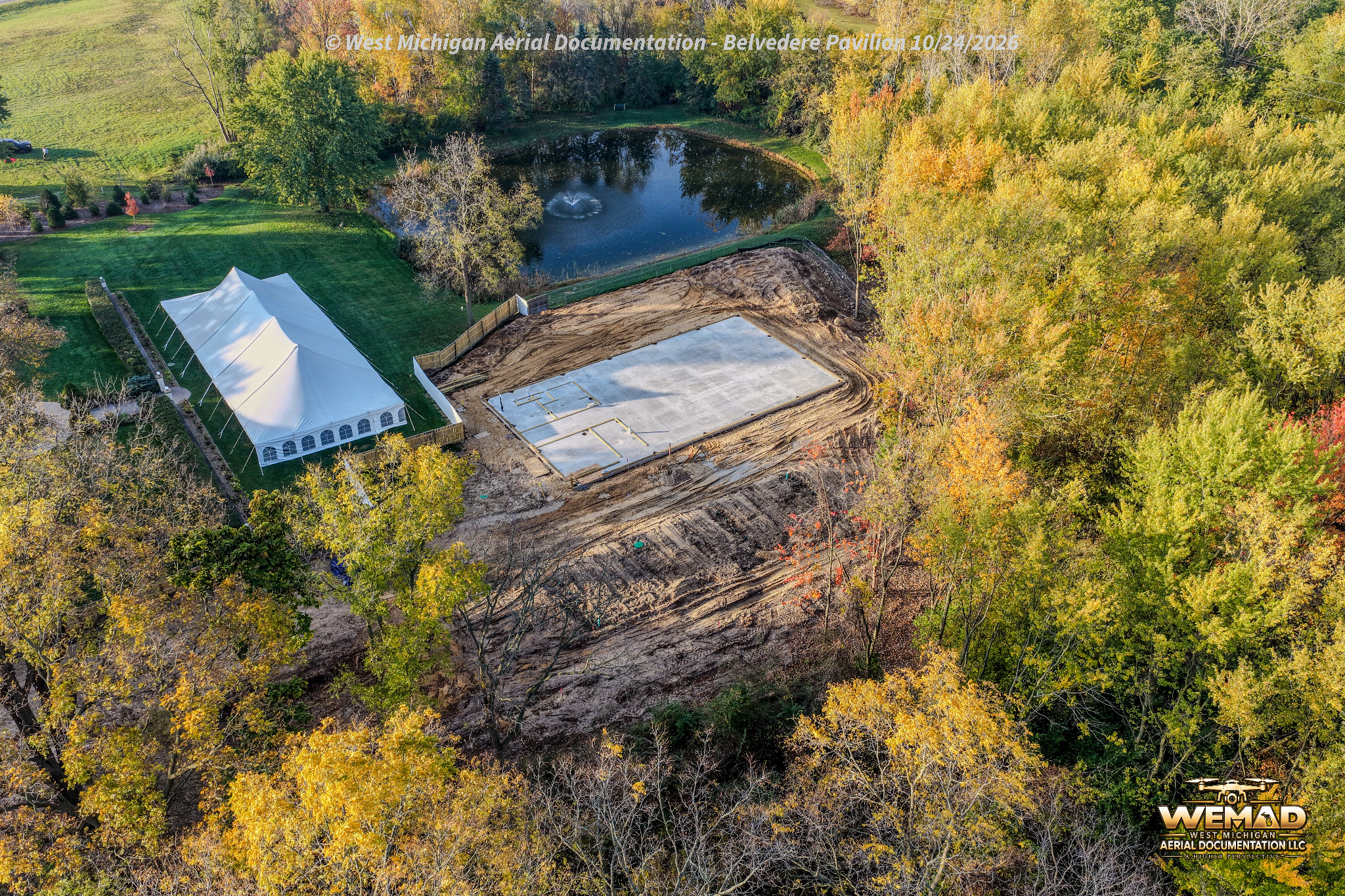
WEMAD’s October 27 surface elevation map places the new pavilion site in context with the existing venue and landscape. The October 24 aerial photographs below show the pavilion slab, surrounding site work, and grounds at Belvedere Estate & Gardens in Saugatuck.

See an earlier project update on Facebook
WEMAD surface elevation map of The Belvedere and new pavilion, with labels identifying the pavilion site, existing venue, and tree canopy and explaining the map’s value
WEMAD mapping work · The Belvedere & new pavilion · October 27, 2026 · Click the image to read the full labeled map.

FEATURED WORK · AERIAL MAPPING & CONSTRUCTION DOCUMENTATION

The new pavilion.
In the context of the whole property.

This view turns overlapping drone photographs into a digital surface model, showing the modeled height of visible ground, buildings, and tree canopy. Read the colors against the elevation scale to see how the new pavilion site sits within the existing venue and landscape. Trees and rooftops are part of the model, so their colors describe those surfaces, including areas where the ground is hidden. Repeat flights at key milestones give owners, builders, and remodelers a dated reference for discussing the work and comparing visible construction progress.

  1. 1
    New pavilion site

    Record the construction footprint and visible progress at this stage of the project.

  2. 2
    Existing venue

    See how the new work relates to existing structures and the surrounding property.

  3. 3
    Tree canopy

    Recognize that vegetation is included in the surface model, alongside buildings and visible ground.

For owners, builders, and remodelers: keep a dated reference, explain work areas to the project team, and compare visible changes across repeat visits. Review the existing setting before planning additions or exterior improvements.

Colors represent modeled elevation, not heat. Numerical measurements and grading decisions require verified site data.

WEMAD aerial view of The Belvedere pavilion concrete slab beside the venue and event tent, October 24, 2026View full photo
01 / SITE CONTEXTBelvedere Estate & Gardens · October 24, 2026
Reverse aerial view of The Belvedere pavilion concrete slab, site work, event tent, and pond, October 24, 2026View full photo
02 / A SECOND PERSPECTIVEPavilion, site work & pond · October 24, 2026

FOR CONTRACTORS, DEVELOPERS & OWNERS

Keep the whole team
in the picture.

From site preparation to the final exterior, plan aerial visits around the milestones that matter to your project.

  • Dated aerial photographs for project updates
  • Repeat viewpoints to follow visible progress
  • Organized images for owners and construction teams

A SIMPLE PROCESS

Built around your milestones.
From first visit to final record.

Let’s plan your visits
01

Tell us what you’re building

Share the location, project stage, and what you want documented.

02

Choose the right moments

We coordinate with your project team around site access and key milestones.

03

Capture, organize, deliver

Receive dated documentation with clear folders, agreed notes, and a usable project record.

Richie and Tammy Campbell smiling together
Richie & Tammy Campbell · Family. Community. Purpose.

ABOUT US

Meet Richie &
Tammy Campbell.

A home is more than a building. It’s where we care for one another, create memories, and invest in our future.

We built a guest home for a loved one so we could provide care and keep family close. That experience gave WEMAD’s work a deeply personal purpose: helping people preserve the story of their build, along with the details they may need years from now.

Get to know us

WHY THIS MATTERS TO US

We’re homeowners, too.
We wish we’d captured more.

We built a home for a family member. We love the finished result—but we wish we had a fuller record of the journey, including aerial views and the systems behind the walls.

The story behind WEMAD
The home begins to feel real.
THE FAMILY-HOME STORY

The home begins to feel real.

Original photos of our founder’s family-home build. They illustrate the milestones that inspired our service, rather than aerial mapping or 360° deliverables.

LOCAL KNOWLEDGE. A HIGHER PERSPECTIVE.

At home on the
West Michigan Lakeshore.

Serving Grand Haven to South Haven, including Holland, Saugatuck, Douglas, and surrounding communities. Grand Rapids projects are welcome.

Tell us where you’re building

A FEW GOOD QUESTIONS

What would you
like to know?

Talk with Richie
Can I hire WEMAD directly as a homeowner?+

Yes. Contact us directly for a new home, vacation home, addition, or remodel. We’ll plan the documentation with you and coordinate timing and site access with your builder.

When should I schedule pre-drywall documentation?+

Contact us during framing and rough-in. The key visit is after the agreed plumbing, electrical, and HVAC work is visible and before insulation or drywall covers it.

What can WEMAD provide for a construction site?+

We scope 2D orthomosaic mapping, 3D site modeling, aerial construction progress monitoring, and interior pre-drywall records for contractors, developers, builders, and owners. Coverage, file formats, visit frequency, and any measurement requirements are agreed before capture.

How are measurements included?+

We agree which measurements matter, record them on site, and enter them as notes. A 360° photo alone does not provide verified dimensions.

What will I receive?+

Your quote specifies the deliverables: 2D orthomosaic imagery, a 3D visual model where suitable, dated aerial photos, organized interior records, plan-linked notes, 360° views, or a progress PDF. Any hosted-access period is agreed in advance.

What does documentation cost?+

Pricing depends on project size, location, milestones, and deliverables. Tell us about the build and we’ll prepare a project-specific quote.

YOUR PROPERTY. YOUR PROGRESS. YOUR PERSPECTIVE.

A single photo visit.
Or the whole story.

Request your project quote Or call Richie at 616.935.2121