Last Updated: October 26, 2026
Quick Summary
Drone services real estate provide aerial views of a property's footprint, landscape, and surrounding context to showcase how the property sits within its environment. These services can include aerial photography, video tours, and progress documentation for construction projects.
- Verify drone providers hold FAA Part 107 certification and liability insurance before hiring
- Aerial views show property lot layout and how outdoor living areas connect to the home
- Construction projects benefit from consistent aerial progress flights documenting completion stages
- Review provider portfolios for examples from properties similar to yours
- Confirm stated delivery schedules align with your listing timeline
Table of Contents
- How Real Estate Drone Photography Transforms Property Marketing
- Real Estate Drone Video and Cinematic Property Tours
- Drone Photography Pricing and Service Selection for Your Property
- Frequently Asked Questions
How Real Estate Drone Photography Transforms Property Marketing
Drone services for real estate can provide aerial views of a property's footprint, landscape, and surrounding context.
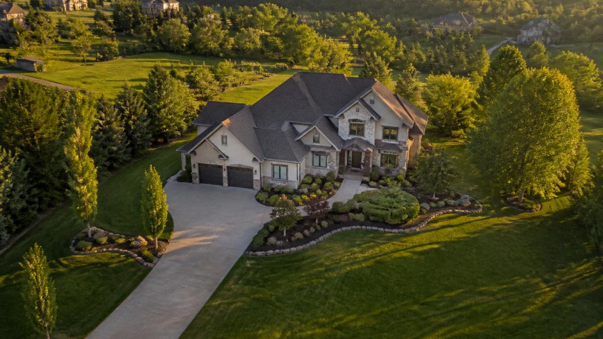
Aerial views can show a property's lot and layout.
Real Estate Drone Video and Cinematic Property Tours
Drone video reveals how a property sits within its environment and how outdoor living areas connect to the home.
Drone Photography Pricing and Service Selection for Your Property
Drone services for real estate can vary in scope and deliverables.
Verify that a provider holds FAA Part 107 certification and is insured.
Request a Flight or construction photography inside and out even in the air →
| Selection Criteria | What to Look For | Why It Matters |
|---|---|---|
| Licensing & Insurance | FAA Part 107 + liability coverage | Legal compliance and property protection |
| Portfolio Quality | Examples from properties similar to yours | Confirms they understand your property type |
| Turnaround Time | Stated delivery schedule | Aligns with your listing timeline |
Show the property with professional aerial photography and put the site in perspective for buyers and investors.
For construction projects, progress flights from consistent positions can document progress from dirt to completion. Plan aerial and interior documentation that gives stakeholders clear evidence of progress.
Frequently Asked Questions
Do real estate drone pilots need an FAA license?
Yes. WEMAD's team is FAA Part 107 licensed and insured.
How much does real estate drone photography cost?
Pricing for drone services for real estate depends on the project. Request a quote from your service provider.
Can drone photos and video help sell a property faster?
Aerial imagery can show a property's land context and outdoor features. WEMAD provides high-resolution aerial photography and 4K video to showcase outdoor assets.
Professional drone services for real estate have moved from luxury to necessity. Buyers expect aerial views in listing presentations, and agents who deliver them close sales faster. Whether you're marketing a residential property, a development site, or tracking construction progress, aerial imagery communicates what words and ground-level photos cannot. The investment in professional drone services typically returns itself through faster sales, higher offers, or clearer project communication.
